During the past 20 years, digital map technology has made it much easier for everybody to find and view geographic information on mobile devices and computers.
Geoinformation is now an essential business tool for companies involved in geomarketing, mobile network development, as well as urban and regional planning. Please contact ISC for advice and specific business proposals concerning the use of the different types of digital map data described in the topic list below.
1. Short guide to using digital maps
1. Short guide to using digital maps
Geoinformation systems require data on specific geographic areas and on the objects and features located in the area. The relevant datasets may include geographic data of different scales for cities, regions and countries, combined with databases of addresses and streets, city infrastructure, and Points Of Interest (POI).
The data can be provided in all current GIS (Geographic Information Systems) formats and the mapping products may be applied for completing various business solutions, for example concerning:
Radio frequency (RF)planning for mobile networks
Radio & TV Broadcasting
Digital mapping products for cities are available in resolutions from 100m down to below 1m. City model datasets consists of up-to-date, accurate terrain (DTM/DEM), clutter, vectors, text labels, orthoimagery.
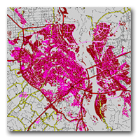
City map
Regional model datasets consist of terrain (DTM), clutter, vectors, text labels, orthoimagery. Regional models are ideal for planning in large areas of a country.
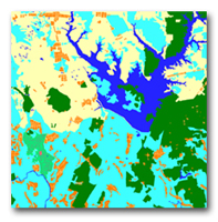
Regional map
Topographic maps with scale 1:100'000 and 1:50'000 for densely populated areas
Satellite images such as Landsat7 or Aster with 15 m and IRS with 5-6 m resolution for densely populated areas
The cell sizes of data model include 20x20m, 50x50m, 100x100m, and 200x200m
The data formats include all major RF planning systems and GIS formats
Recent satellite images are used for a variety of tasks, e.g. digital models preparation and updating.
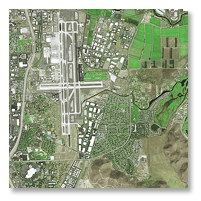
SPOT satellite image
Microplanning of cities requires three dimensional (3D) model including data on all above-ground features and city infrastructure such as buildings, bridges, vegetation. Such geoinformation solutions are ideal for network planning and optimization in dense city areas and city centres.
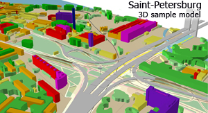
3D model
Stereo models require city plans of scale 1:10 000 or better, and Ground Control Points collected by precise GPS-receivers. Stereo pairs of satellite images may be provided by EROS B, Ikonos, WorldView 1, GeoEye 1 with 0.5-1 m resolution or airphotos.The heights of city buildings in city and vegetative cover may be determined on the basis of processing of stereo pairs.
3D models may be prepared in any RF- planning system format.
Please contact ISC for advice and specific business proposals.